To get to the office (no idea what the hours are, but it was open at 9:20 AM on a Saturday, so that much we know), you need to get onto 149. From the north coast, that goes south from Manatí, and from the south, it goes north from Juana Díaz. Either way, on the Central Cordillera, you'll get onto 143 going east. (That's a left turn heading south, or a right heading north.) The office is on the north side of the road, at kilometer 32.4.
If you're coming from Ponce, you can also take the 10 north towards Adjuntas, and pick up 143 there; 143 follows the Cordillera Central and it's also called the Ruta Panorámica, for good reason. By my clock, the route along 10 is about ten minutes longer, but with somewhat less "squiggle". The route through Villalba along 149, from Ponce to the office building, was about an hour.
Now, if you've never driven in Puerto Rico before and you're just looking at a map, you may think this is a short, even a trivial, drive, and wonder how on earth it could take an hour or more. It is not a trivial drive. When I say "squiggle," I mean these roads are a lane and a half wide, and if they were stretched out straight they'd go from LA to Chicago, and everybody and their mother takes them at roughly three hundred miles an hour -- honking as they go, in case somebody's around the next bend. This is basically 149 north of Villalba, and a good chunk of 143 no matter where you are on it. Bring Dramamine if you or the kids has a tendency to get carsick. But all of this applies to any trip into Puerto Rico's interior, and if you've been here any length of time, you already know this.
Once you get to the Recreational Area, there are a number of good trails. Here's a map, obtained from the office and scanned (after the hike, so it's a little folded up. Sorry.) This GIF, of manageable size, is probably not too suitable for printing, so click it for a much larger JPEG copy if you want to print this map.
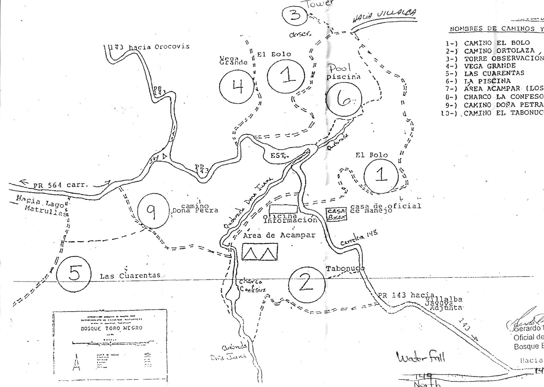
We parked at the vaguely stomach-shaped parking area on the map (labeled "EST." on PR143 just past the office.), then walked up PR143 to get to trail 1. We then walked up trail 3 to the observation tower. The hike was absolutely fantastic; the trails are well-maintained and the tower has a great view.
